
Pakistan’s Major Mountain Ranges and Glaciers: NTS Preparation Guide
Pakistan is home to some of the world’s most impressive mountain landscapes. The northern and western parts of the country contain major mountain systems, high-altitude peaks, valleys, and glaciers. These geographical features are frequently included in General Knowledge and Pakistan Studies questions for NTS, PPSC, FPSC, CSS, PMS, and other competitive examinations.
For test preparation, candidates should not only memorize the names of famous mountains. It is more useful to understand which mountain range a peak belongs to, where it is located, how high it is, and which glaciers or geographical features are associated with it.
Major Mountain Ranges of Pakistan
Pakistan has several important mountain systems, including the Karakoram, Himalayas, Hindu Kush, Suleiman Range, Kirthar Range, and Salt Range. These ranges differ considerably in location, elevation, climate, and geological characteristics.
The three most important ranges for questions about Pakistan’s highest peaks are the Karakoram, Himalayas, and Hindu Kush.
The Karakoram is particularly significant because it contains K2, the second-highest mountain on Earth. The Himalayas include Nanga Parbat, while the Hindu Kush extends through the northwestern part of the country.
Karakoram Range
The Karakoram is one of the most prominent mountain systems in northern Pakistan. It extends across Pakistan, India, and China and contains some of the highest peaks on the planet.
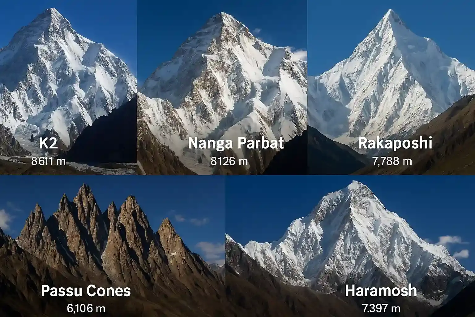
The most famous peak of the Karakoram is K2, which rises to 8,611 meters above sea level. It is the highest mountain in Pakistan and the second-highest mountain in the world after Mount Everest.
K2 is located in the Gilgit-Baltistan region and is also known by the name Mount Godwin-Austen. Because of its extreme altitude and difficult climbing conditions, it has become one of the most recognized mountains in international mountaineering.
Other notable peaks associated with the Karakoram include Broad Peak, Gasherbrum I, and Gasherbrum II.
For NTS preparation, remember:
K2 → 8,611 m → Karakoram → Gilgit-Baltistan
Nanga Parbat and the Himalayas
Nanga Parbat is one of Pakistan’s best-known mountains and is part of the western Himalayas. It has an elevation of approximately 8,126 meters, making it one of the world’s fourteen peaks above 8,000 meters.
The name Nanga Parbat is commonly translated as “Naked Mountain.” The mountain is located in Gilgit-Baltistan and is especially prominent around the Diamer region.
Nanga Parbat has considerable importance in mountaineering history. German-Austrian climber Hermann Buhl made the first successful ascent in 1953.
For an NTS candidate, several facts can be connected together:
Nanga Parbat → Himalayas → 8,126 m → Hermann Buhl
Learning facts in connected groups makes them easier to recall during an examination.
Broad Peak
Broad Peak is another famous mountain of the Karakoram. It has an elevation of 8,047 meters and is situated close to K2 in the Gilgit-Baltistan region.
The mountain received its name because of the broad summit area. It is one of the fourteen mountains on Earth whose elevation exceeds 8,000 meters.
The first successful ascent of Broad Peak took place in 1957 by an Austrian expedition.
An important point for candidates is that Broad Peak should not be confused with K2. Both are located in the Karakoram, but K2 is considerably higher.
A simple revision chain is:
Broad Peak → Karakoram → 8,047 m → first ascent in 1957
Gasherbrum Peaks
The Gasherbrum group contains several major peaks in the Karakoram. Two of the best-known are Gasherbrum I and Gasherbrum II.
Gasherbrum I is commonly known as Hidden Peak. Its elevation is approximately 8,080 meters. Gasherbrum II reaches approximately 8,035 meters.
The word “Gasherbrum” is frequently encountered in Pakistan Geography and General Knowledge questions, particularly when examination setters ask about high-altitude peaks.
Candidates should remember that Gasherbrum I is also called Hidden Peak.
Gasherbrum I → Hidden Peak → Karakoram
Hindu Kush Range
The Hindu Kush is another important mountain system associated with northern and northwestern Pakistan. It extends through Afghanistan and Pakistan and connects with other major mountain systems of the region.
One of its most important peaks in Pakistan is Tirich Mir, which reaches approximately 7,708 meters. It is the highest peak of the Hindu Kush.
Tirich Mir is located in Chitral, in Khyber Pakhtunkhwa.
This creates another useful examination association:
Tirich Mir → Hindu Kush → Chitral → 7,708 m
Candidates should distinguish Tirich Mir from K2 and Nanga Parbat because all three are major Pakistani peaks but belong to different mountain systems.
Salt Range
The Salt Range is located mainly in Punjab and is considerably lower than the great northern mountain systems.
Its highest point is Sakesar, which reaches approximately 1,522 meters. The range is important not because of extreme altitude but because of its geological characteristics and location in the Punjab region.
The Salt Range is also associated with deposits of rock salt, which have economic importance.
For NTS questions:
Salt Range → Punjab → Sakesar
This is a good example of why candidates should study Pakistan’s geography beyond the northern mountains.
Kirthar Range
The Kirthar Range is situated mainly along the boundary between Sindh and Balochistan. It forms an important geographical feature of western Sindh and extends toward Balochistan.
Unlike the Karakoram and Himalayas, the Kirthar Range is not known for extremely high peaks. However, its location makes it relevant to Pakistan Studies and provincial geography questions.
A common examination question asks which major mountain range is associated with Sindh. The answer is generally Kirthar Range.
Major Glaciers of Pakistan
Pakistan contains extensive glaciated areas, particularly in Gilgit-Baltistan and the northern mountain regions. Glaciers are important sources of freshwater because their seasonal melting contributes to river flows.
Among Pakistan’s most famous glaciers are Baltoro, Biafo, Hispar, Siachen, and Batura.
These glaciers are closely connected with the Karakoram region.
Baltoro Glacier
The Baltoro Glacier is one of the most famous glaciers in Pakistan. It is located in the Karakoram and provides access to some of the world’s highest mountains.
Several major peaks, including K2 and Broad Peak, are located in the wider region around the Baltoro Glacier.
The glacier is therefore particularly useful to remember in connection with high-altitude mountaineering.
Siachen Glacier
Siachen is another major glacier in the Karakoram region. It is located in the eastern part of the Karakoram and has considerable geographical and strategic significance.
For competitive examinations, candidates commonly encounter Siachen in questions involving glaciers, mountain ranges, and the geography of the northern areas.
Biafo and Hispar Glaciers
Biafo and Hispar are major glaciers of the Karakoram and are notable because they form an extensive glacial system in the region.
Their geographical importance is linked to the high-altitude valleys and mountain passes of northern Pakistan.
Rather than memorizing every glacier separately, candidates can organize them under the broader heading:
Karakoram → Baltoro, Biafo, Hispar, Siachen, Batura
Why Pakistan’s Mountains and Glaciers Matter
Pakistan’s mountains have importance beyond General Knowledge questions. They influence climate, water resources, tourism, biodiversity, agriculture, and energy production.
Snow and glacial melt contribute substantially to the flow of rivers in the Indus Basin. During warmer periods, melting snow and ice provide additional water to downstream areas.
The mountain regions also attract climbers, trekkers, and tourists from around the world. K2, Nanga Parbat, Broad Peak, and the Gasherbrum peaks have made Pakistan an important destination for high-altitude mountaineering.
At the same time, changing temperatures can affect glaciers and water availability. This makes the study of glaciers relevant to environmental science and current affairs as well as geography.
Quick NTS Revision Table
| Mountain/Feature | Range/Region | Key Fact |
| K2 | Karakoram | 8,611 m; highest peak of Pakistan |
| Nanga Parbat | Himalayas | 8,126 m; “Naked Mountain” |
| Broad Peak | Karakoram | 8,047 m |
| Gasherbrum I | Karakoram | Also called Hidden Peak |
| Tirich Mir | Hindu Kush | Highest peak of Hindu Kush |
| Sakesar | Salt Range | Highest peak of Salt Range |
| Baltoro Glacier | Karakoram | Major glacier near K2 region |
| Siachen Glacier | Karakoram | Major glacier in eastern Karakoram |
| Biafo Glacier | Karakoram | Major high-altitude glacier |
| Hispar Glacier | Karakoram | Important glacier of northern Pakistan |
Important Facts for NTS Preparation
Before an NTS test, revise these combinations carefully:
- K2 — Karakoram — 8,611 meters
- Nanga Parbat — Himalayas — 8,126 meters
- Broad Peak — Karakoram — 8,047 meters
- Gasherbrum I — Hidden Peak
- Tirich Mir — Hindu Kush — Chitral
- Sakesar — Salt Range
- Kirthar Range — Sindh/Balochistan region
- Baltoro — Karakoram
- Siachen — Karakoram
- Biafo and Hispar — Karakoram
MCQsDrive’s Pakistan Studies section similarly emphasizes K2, Broad Peak, Gasherbrum, Nanga Parbat, and other mountain-related facts, making this a useful area to include in an NTS preparation plan.
Final NTS Preparation Strategy
The easiest way to prepare Pakistan’s mountain geography is to build a Peak → Range → Location system.
For example:
K2 → Karakoram → Gilgit-Baltistan
Nanga Parbat → Himalayas → Gilgit-Baltistan
Tirich Mir → Hindu Kush → Chitral
Sakesar → Salt Range → Punjab
For glaciers, use the same approach:
Baltoro → Karakoram
Siachen → Karakoram
Biafo → Karakoram
This approach is more effective than trying to memorize hundreds of isolated facts. Once the major mountain ranges are clear, individual peaks and glaciers become much easier to place.
For NTS candidates, the most important figures to revise are the elevations of major peaks, alternative names such as Hidden Peak, the first-ascent facts of famous mountains, and the relationship between peaks and mountain ranges.
A final revision of these connected facts can help candidates handle direct questions, matching questions, and questions that test geographical relationships rather than simple memorization.